Paddle Florida®
Over 100 Florida Paddling Destinations
E-Z Maps... Photos... Reports...
You are here > Home >
Florida Panhandle >
Shoal River
Latest update: October 2022
Shoal River...
Kayaking and Canoeing in the Florida Panhandle
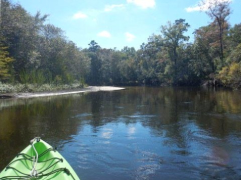
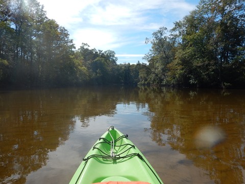
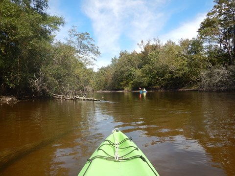
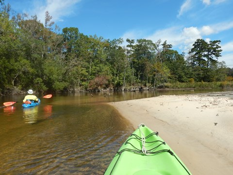
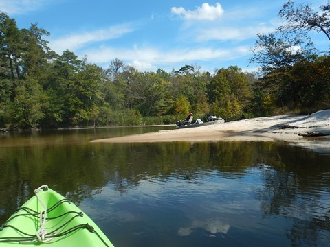
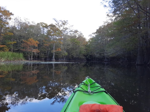
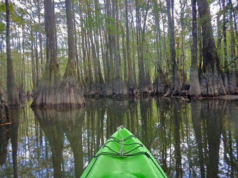
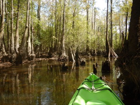
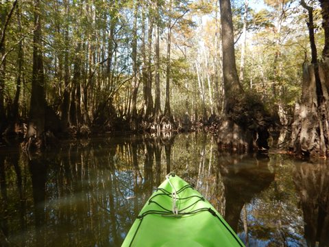
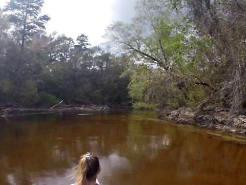
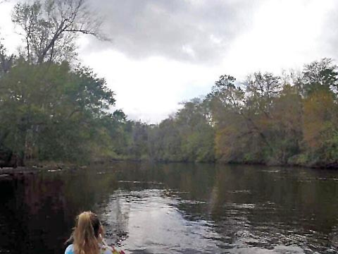
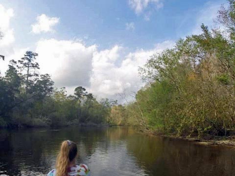
The Shoal River in the Florida Panhandle is swift-flowing, wide and mostly shallow (at normal water levels). Named for its many shoals, there are a few sandbars for easy stopping. The river flows through mostly undeveloped forested area. A tributary of the Yellow River (link below), they join near Crestview. The Designated Paddling Trail runs 9.5 miles from Ray Barnes Public Boat Ramp (SR 90) south to Bill Duggan Jr. Park (SR 85). We kayaked a short distance upstream and back from the SR 85 launch, a workout similar to many swift flowing rivers and creeks in the Panhandle. We also include a downstream canoe trip report on the entire paddling trail by Josh Fulford, a lifetime local - thanks Josh! (Detailed map and photos below)
Distance: 9.5 mile Designated Paddling Trail (total
is longer)
Location: Okaloosa County (Crestview)
Difficulty: Easy to moderate
Tidal: No
Launch points: Ray Barnes Public Boat Ramp
(SR90, mile 0), Bill Duggan Jr. Park (SR 85, mile 9.5) (See map)
Nearby Points of Interest: Blackwater River State Park,
Henderson Beach State Park
Rentals/Outfitters/Tours:
N/A
Page Summary:
- Paddling on Shoal River
- Launches
- Ray Barnes Public Boat Ramp (North, Mile 0)
- Bill Duggan Jr. Park (South, Mile 9.5) - Paddling from Bill Duggan Jr. Park - South to North and Return
- Paddling from Ray Barnes Public
Boat Ramp - Shoal River North to South
- Paddling on Shoal River by Josh Fulford - More Information and Resources
Paddling on Shoal River... Comments and Photos
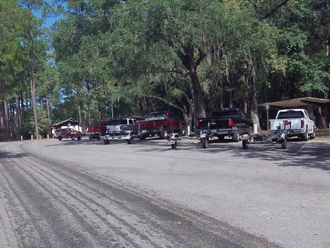
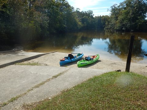
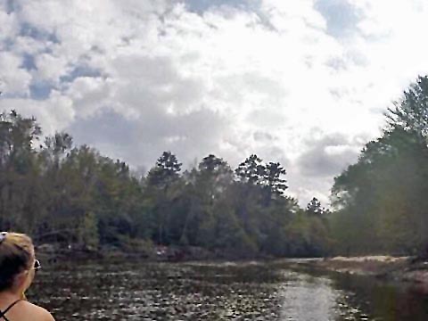
We visited both launches on the Paddling Trail. Both have paved parking and hand-launch areas that are easy on-off. Both contain designated trailer parking spots, so paddlers may encounter one or two small motorboats, typically fishermen, but with the many obstructions in the water, they will likely be going very slow. Other paddlers have commented on the abundant wildlife, but on our paddling trip, we saw very little. Water levels can vary - at low water be prepared to for a few pull overs (we noted several cut logs keeping the river open), while at high water the river flows faster, making paddling more technical (check the gauge monitors ). While it's navigable downstream from the SR 85 launch to the Yellow River, an Eglin Air Force Base recreation permit is required in this section.
Launches on Designated Paddling Trail
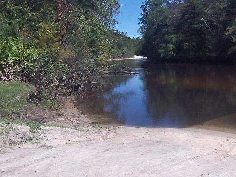
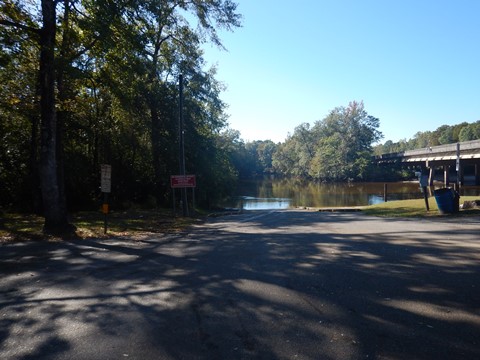
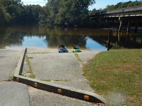
Ray Barnes Public Boat Ramp (North, Mile 0)
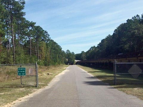
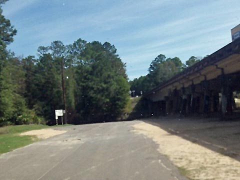
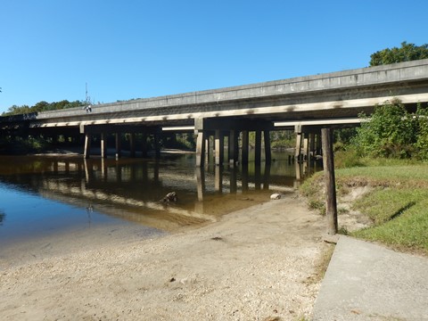
The Ray Barnes Public Boat Ramp is off the road under the SR 90 bridge. The concrete ramp is shared, or launch from the sandy area next to it. Ample parking including boat trailers, no other facilities. No fee.
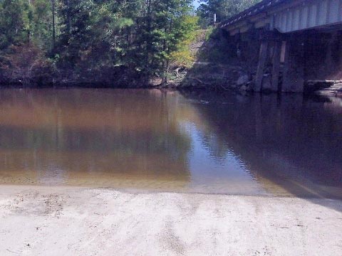
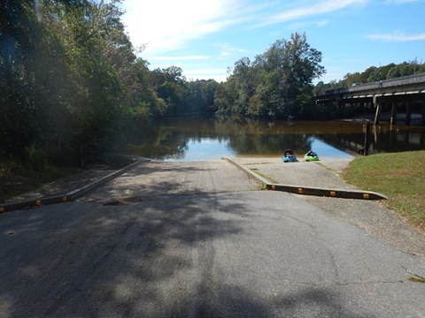
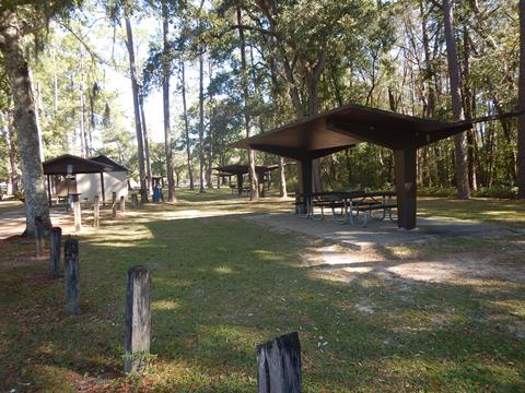
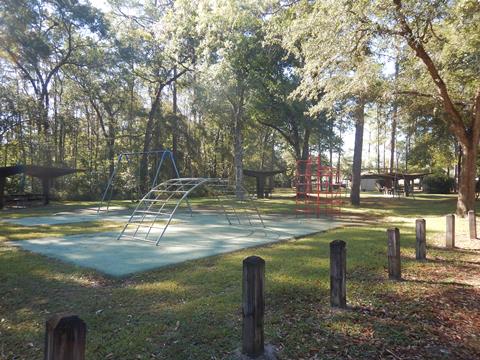
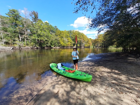
Bill Duggan Jr. Park (South, Mile 9.5)
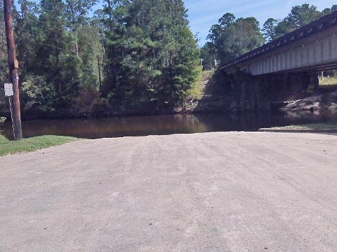
Bill Duggan Park (AKA Wayside Park) at SR 85 includes restrooms, playground, picnic area and ample paved parking including boat trailers. Launch from sandy area next to the concrete boat ramp. No fee.
Paddling from Bill Duggan Jr. Park (SR 85)
Kayaking Upstream and Back
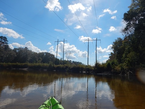
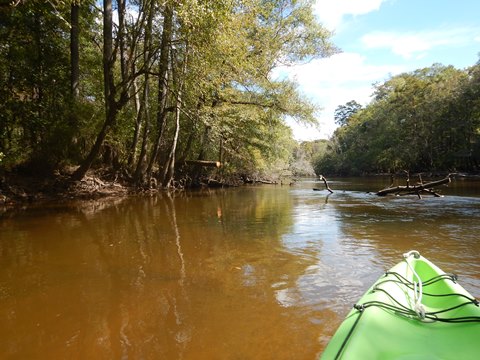
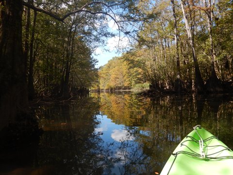
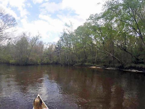
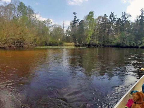
We launched from Bill Duggan Jr. Park, paddled upstream about two miles and returned. Going against the current, it was a moderate workout, but we enjoyed the endorphins pumping on the relaxed trip back. After leaving the road noise behind (after about 3-4 bends in the river - depending on the wind), we were finally able to fully enjoy the quiet and pristine forest surroundings. Some sandbars for pulling off, we didn't run into any significant blockages in this section, and saw several freshly cut trees. While scenic, there is not a lot of variety and we didn't see any wildlife this day. A fisherman we passed told us about a scenic creek not too much further, past the upcoming power lines, so we continued on.

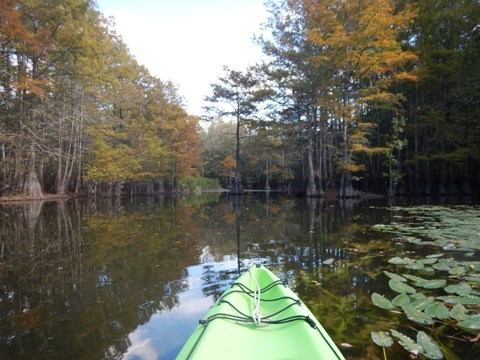
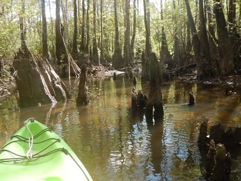
On a Side Creek
Shown as "King Branch" on the Google map, this side creek can be paddled only a short distance before the cypress knees become too thick, but it provided some of the best scenery along the river - we enjoyed navigating our sit-on-top kayaks as far as we were able. A small, clear streamlet pours out near the start of the creek, we thought it might be a spring.

Paddling from Ray Barnes Public Boat Ramp (SR 90)
Shoal River - North to South
Paddling on Shoal River by Josh Fulford
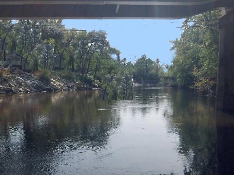
We launched at the east Hwy. 90 boat launch, it’s easier to back your vehicle to the water’s edge, unload, then go park your car under the bridge. There are signs marking truck and trailer parking only nearest to the water’s edge - I've been asked to move or be moved. The South Hwy. 85 launch also has designated truck and trailer only parking areas. As far as I know there are no shuttles from launch to launch, other than the occasional Good Samaritan. Also as a side note I’d be wary of these launches during low light or night conditions, as some of the people around here are a little sketchy (I’ve been living here all my life). Now for actual river paddling details:
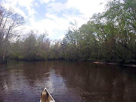
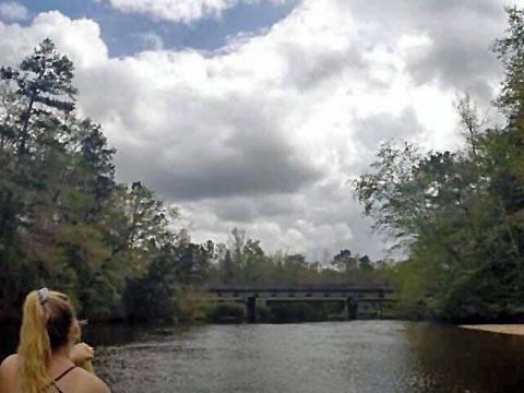
We started out at the east Hwy. 90 launch and paddled downstream. For the first mile or so it’s pretty straight forward and easy going. There is a power line and a RR bridge you cross under. After the RR bridge the river gets more and more twisty - nothing un-navigable. Sand bars are bountiful pretty much the whole way down the river. There are 2 or 3 spots during this paddle that get a little nerve wracking but once again, it’s not un-navigable in a canoe or kayak (we did it in a 17-foot canoe). There is one of these blockages that is tougher than the others - you have to stop the canoe/kayak completely, turn sideways and pull yourself through the fallen timbers (you can stay in the vessel while doing this). Other than that, everything is pretty smooth paddling. You will pass a few waterfront properties, a couple of small side creeks, and several small hunting camps.
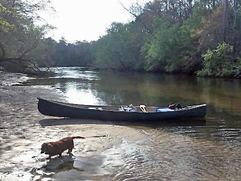
It would be impossible to miss the Hwy. 85 south launch, it’s visible for probably a quarter mile while paddling. It’s a sense of accomplishment when you see the launch, but you don’t want it to end.
Wildlife includes birds, deer, wild hogs, snakes, bream, largemouth bass, catfish, spiders, and mosquitoes as big as hawks, so make sure you bring bug spray.
I’d rate this paddle easy 97.5% of the time the other 2.5% is moderate considering the blockages.
More Information and Resources
Nearby Paddling:
Yellow River
See FL Panhandle Region
for more paddling
Nearby Biking:
Blackwater Heritage State Trail
Related Resources:
Florida Office of Greenways and Trails-Shoal River Designated Paddling Trail (.pdf)
View great paddling by FL Region or Listed A - Z

PaddleFlorida.net... Find Florida's Best Recreational Paddling,
by Kayak, Canoe, and Paddleboard too.
Copyright © PaddleFlorida.net. All Rights Reserved. Paddle Florida®