Paddle Florida®
Over 100 Florida Paddling Destinations
E-Z Maps... Photos... Reports...
You are here > Home >
East-Central FL >
Alexander Spring Run
Latest update: January 2017
Alexander Springs Run...
Paddling in the Ocala National Forest, Florida
Alexander Springs is a first-magnitude spring that feeds Alexander Creek ("Spring Creek" on the Google map). The paddling trail runs from the Alexander Springs Recreation Area to the FR52 Landing, a distance of about 6.5 miles. Unlike nearby Juniper Springs, Alexander Springs immediately opens up into a wide, slow-flowing run. There is no regular shuttle service between landings, so for most visitors this is an out and back paddle. Canoe and kayak rentals are available. A few older (grandfathered in) houses on the south side of the run - the only ones seen along the trail - mark roughly the halfway point between the Alexander Springs and FR52 launches. State park fee applies. (Detailed map and photos below.)
Distance: 6.5 miles to 52 Landing (FR18/552); 14 miles to the St. Johns River
Location: Lake County (Altoona), Ocala National Forest
Difficulty: Easy to Moderate
Tidal: No
Launch points: CR 445 bridge, 552 Landing (at FR 552), Alexander Springs Recreation Area
(fee-based) (See map)
Nearby points of interest: Ocala National Forest
Rentals/Outfitters:
Alexander Springs
Recreation Area
(rentals, at concession stand)
Page Summary:
- Paddling on Alexander Spring Run
- Launch from Alexander Springs Recreation Area
- Launch to CR445 bridge
- Alexander Springs Recreation Area - Launch at CR445 bridge
- Launch at 552 Landing
- Upstream toward Recreation Area
- Downstream toward St. Johns River - Wildlife
- More About Alexander Springs Recreation Area
- More Information and Resources
Paddling on Alexander Spring Run... Comments and Photos
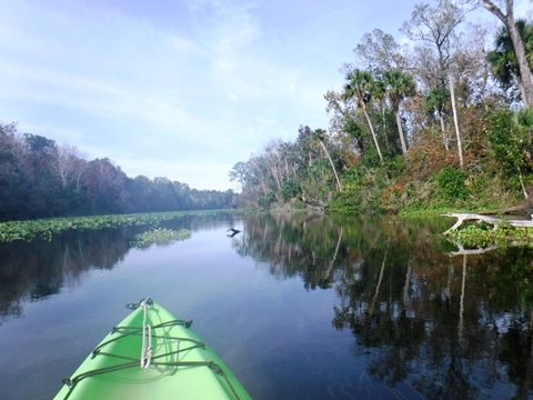
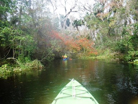
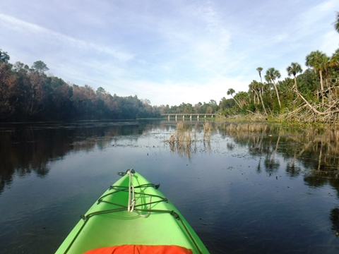
The run is usually open and is an easy trip. The first 5 miles is a broad, slow-moving stream, with virtually no shade. Some sections of thick vegetation can be a workout. The central section is a more narrow, winding stream with some shade. Then the stream becomes broad and slow moving again before flowing into the St. Johns River. Paddling the last section through to the St. Johns River is for experienced paddlers only; the channel may be hard to follow, there are no take-outs, and once on the St. Johns, it's almost 7 miles to the nearest marina.
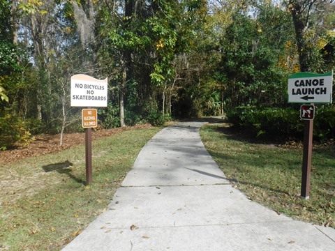
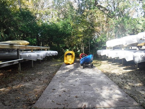
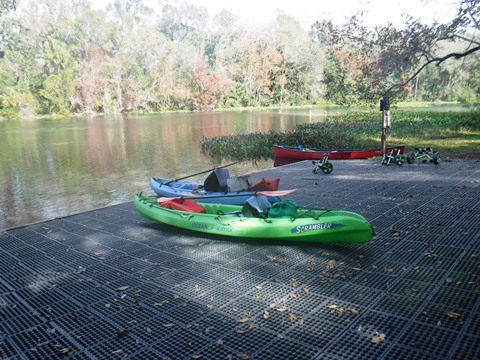
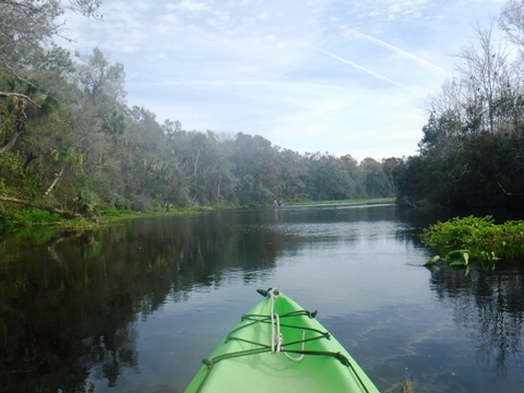
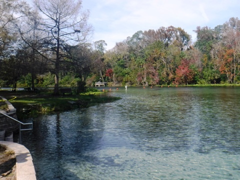
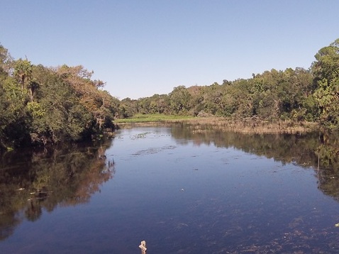
Launch from Alexander Springs Recreation Area
Launch to CR445 bridge
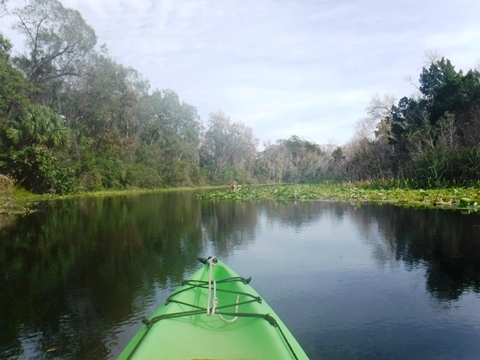
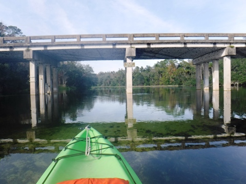
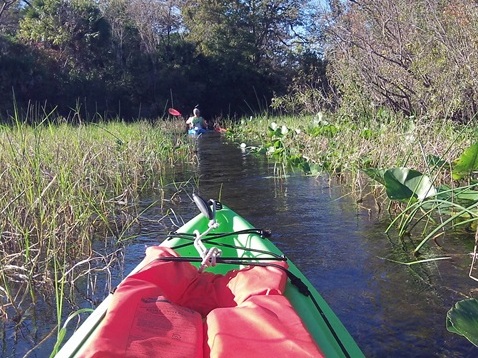
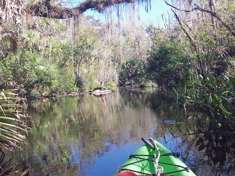
The launch is down a (long) paved ramp from the staging area, carts are provided. Kayak, canoe, and paddleboard rentals are available. From the launch, it's about 1 mile to the CR445 bridge. We paddled about a mile past the CR445 as an out-and-back. With no regular shuttle service, the vast majority of paddlers do this same 2- to-4 mile round-trip. Wide, beautiful water dotted with wading birds. But little shade or shelter from wind, so pick a cool, calm day for maximum enjoyment. Some side creeks are off the main run, we explored a couple of them but couldn't get far.
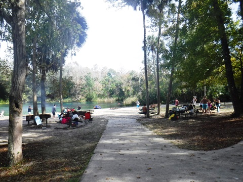
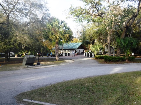
Alexander Springs Recreation Area
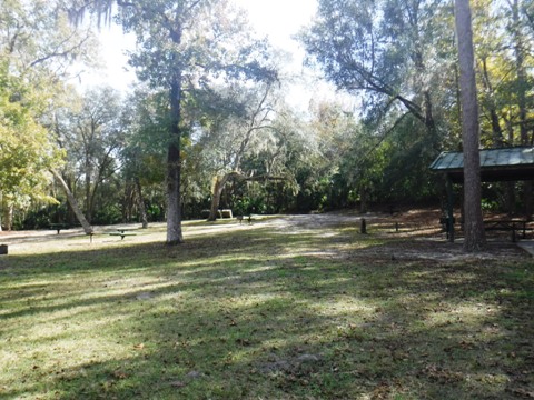
From the launch, the main spring is blocked to paddlers. The recreation area includes parking, restrooms, concession, swimming at the spring, camping, and picnicking.
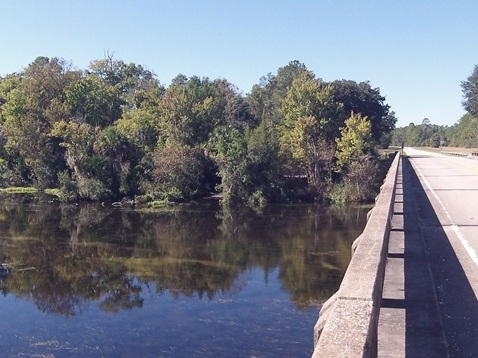
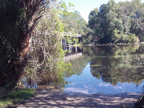
Launch at CR445 bridge
No fee; just across the road and outside of the Alexander Springs Recreation Area. Motor boats not allowed upstream of the bridge. Unpaved, limited parking.
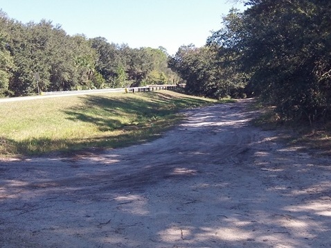
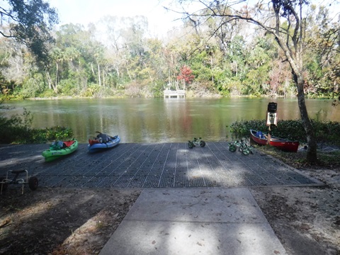
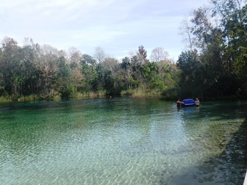
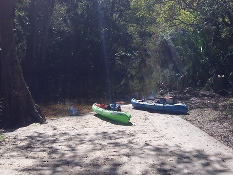
Launch at 552 Landing
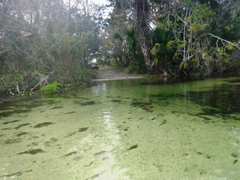
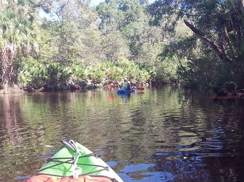
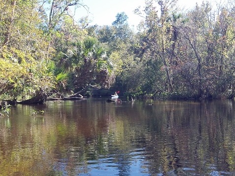
From the turn-off at CR 445, a National Forest road (FR 552) runs about 4.5 miles to the launch along Spring Creek. From here, we paddled upstream toward the Recreation Area and then downstream a couple of miles below the landing toward the St. Johns. This is an easy launch, with a slightly elevated concrete ramp (occasional fisherman with small motor boat). Note: this is a remote area. Do not leave valuables in vehicle.
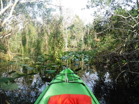
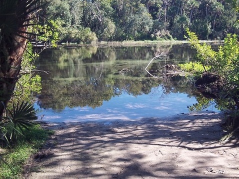
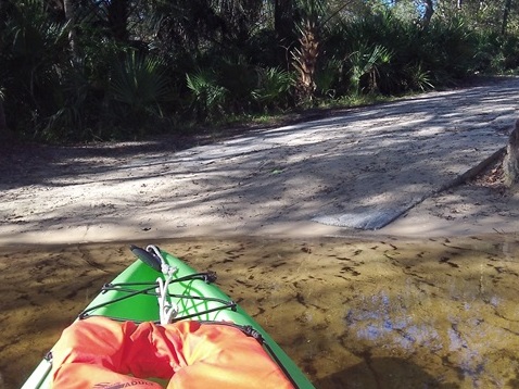
Upstream from 552 Landing - toward Recreation Area
It starts out with a shallow sand bottom, and nicely shaded through a forested area. Not far upstream the run opens up, winding through grassy flats, too wide for the surrounding forest to provide much shade. As the run widens, grassy areas can make paddling upstream moderately difficult.
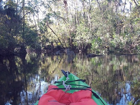
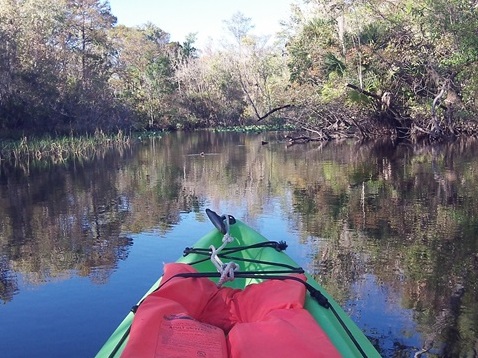

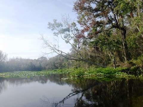
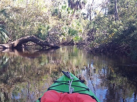
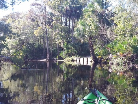
Downstream from 552 Landing - toward St. Johns River
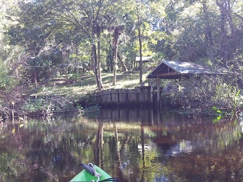
Easy paddling through floodplain forest and no beaches for pull off. About 1.7 miles downstream is a bluff with an old launch where it's possible to stop and stretch.
Wildlife
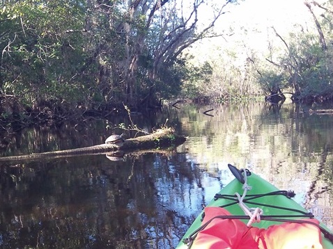
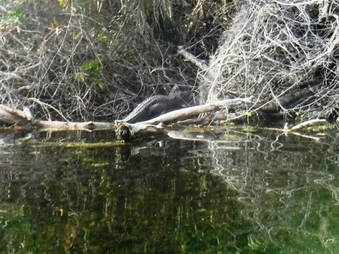
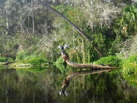
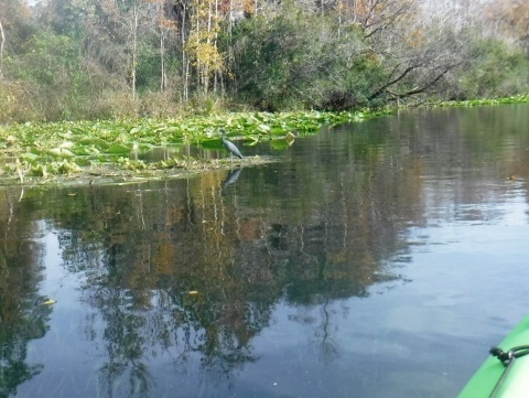
Diverse wildlife can be seen along the run, including birds, fish, deer, otters, raccoons, turtles, bears and of course alligators.


More About Alexander Springs Recreational Area
Alexander Springs Recreational Area is a popular destination with camping, picnicking, snorkeling, a boardwalk, and hiking - this is the only area in the Ocala National Forest where scuba diving is permitted. Two segments of the Florida National Scenic Trail run through the area. The Alexander Wilderness Area lies between Alexander Springs and Lake Dexter. There are no trails or roads, the only access is by water (kayak, canoe).
More Information and Resources
Nearby Paddling:
See FL East-Central Region for more paddling
Related Resources:
USDA Forest Service -
Alexander Run
USDA Forest Service - Alexander Springs Recreation Area
View great paddling by FL Region or Listed A - Z

PaddleFlorida.net... Find Florida's Best Recreational Paddling,
by Kayak, Canoe, and Paddleboard too.
Copyright © PaddleFlorida.net. All Rights Reserved. Paddle Florida®