Paddle Florida®
Over 100 Florida Paddling Destinations
E-Z Maps... Photos... Reports...
You are here > Home >
West Central Florida >
Myakka River
Latest update: April 2022
Myakka River Kayaking...
Where River and Prairie Meet the Sky
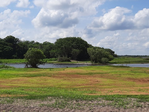
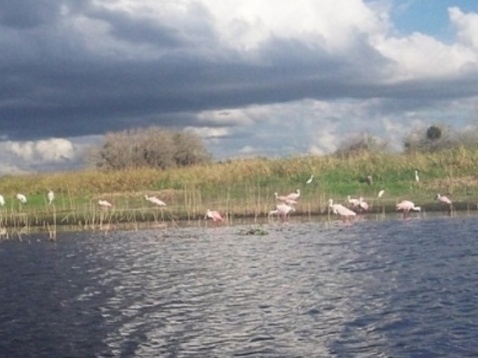
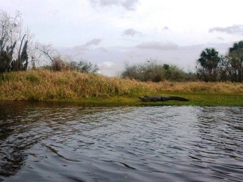
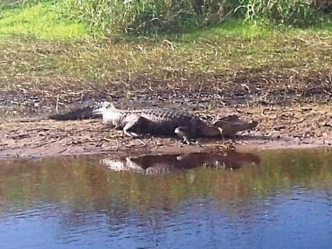
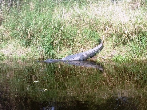
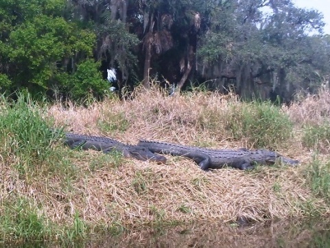
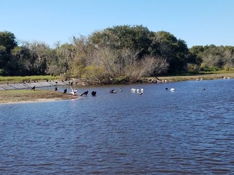
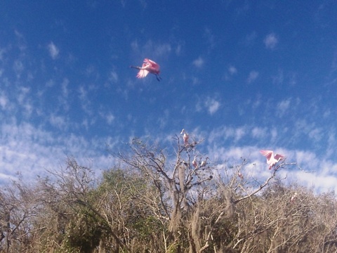
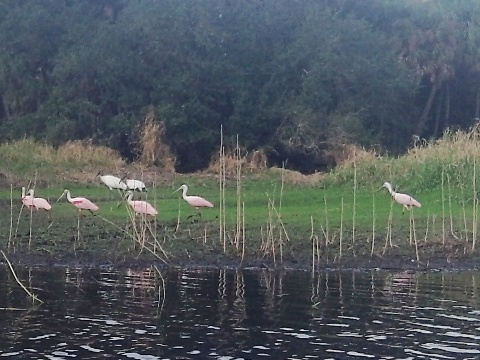
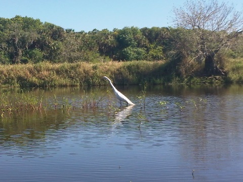
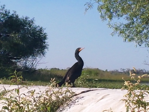
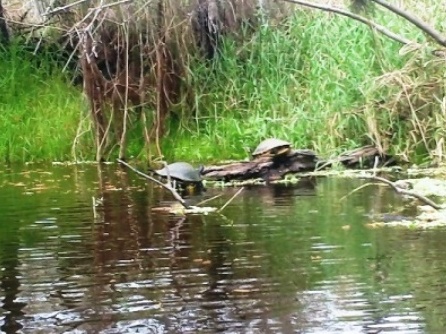
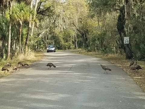
The Myakka River, a Florida "Wild and Scenic River," flows 68 miles from the Hardee-Manatee county line to Charlotte Harbor and the Gulf of Mexico. 14 miles are located within Myakka River State Park and the best recreational paddling is here. Famous for the large number of alligators, birds also abound, including the most roseate spoonbills we've seen. (Detailed map and photos below.)
Distance: 68 miles total, 14 miles within Myakka River
State Park
Location: Manatee, Sarasota and Charlotte Counties
Difficulty: Easy to Moderate
Tidal: Upper river, no.
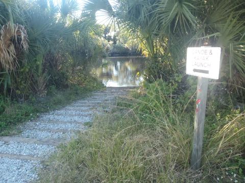
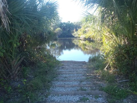
Launch points: At Upper Lake Myakka near the concession
stand, along the State Park road, Snook Haven, Deer Prairie Creek Preserve
(See map)
Nearby points of interest: Sarasota, Ringling Museums
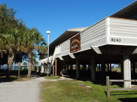
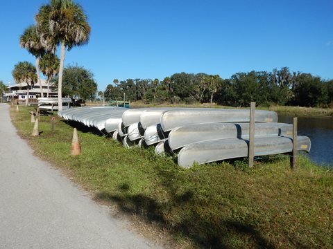
Rentals/Outfitters/Tours:
Myakka
Outpost (rentals,
cafe, camp store, information)
Snook
Haven
(rentals)
Support and Advocacy:
Page Summary:
- Paddling on the Myakka River
- Launching onto Lake Myakka (upper)
- Paddling on South Side of Lake Myakka - Launching onto the River from the Park Road
- Myakka River to Lower Lake Myakka - Myakka River State Park
- About the Park, Wildlife - Nearby Launches
Snook Haven Park, Deer Prairie Creek Preserve - More Information and Resources
Paddling on the Myakka River... Comments and Photos
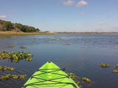
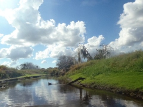
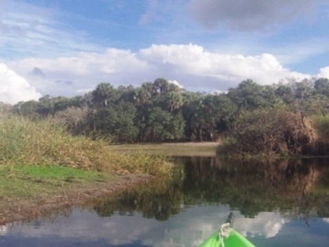
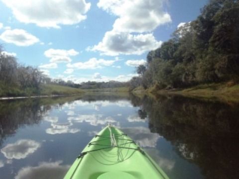
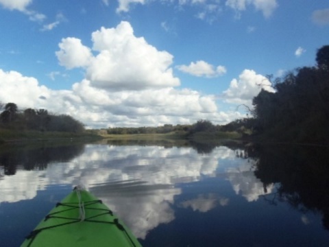
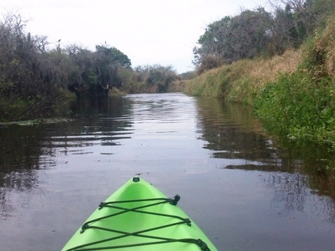
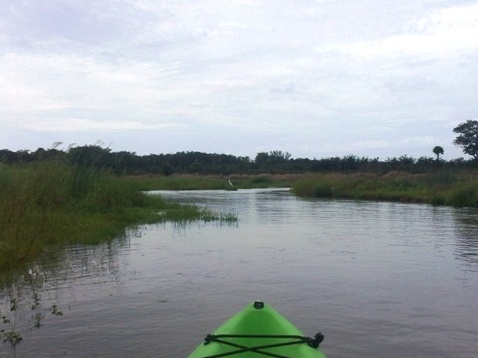
We paddled the Myakka River at Myakka River State Park on several trips: from Lake Myakka (upper) downstream to Lower Lake Myakka, and upstream from the north end of the upper Lake, until stopped by vegetation. The river alternates from wide flats to narrow channels with very little shade. Flowing mostly through open prairie, the horizons are endless making "where river and prairie meet the sky" an apt description. At low water, it will be necessary to portage in some areas.
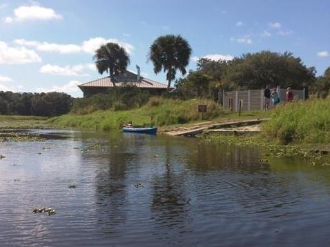
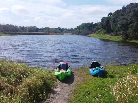
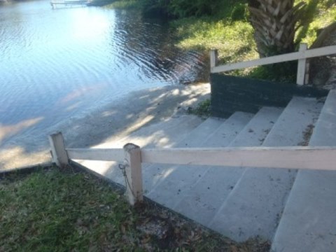
Launching onto Lake Myakka (upper)
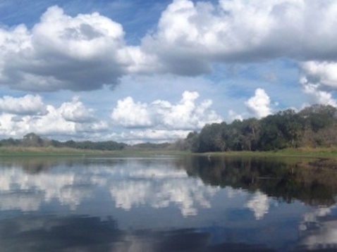
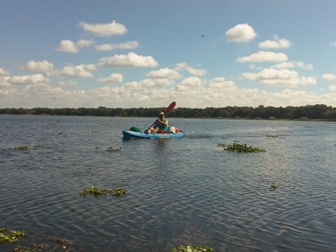
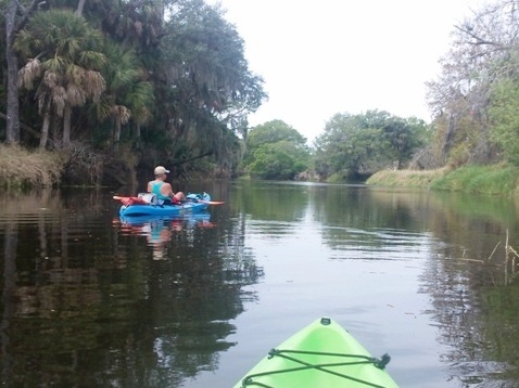
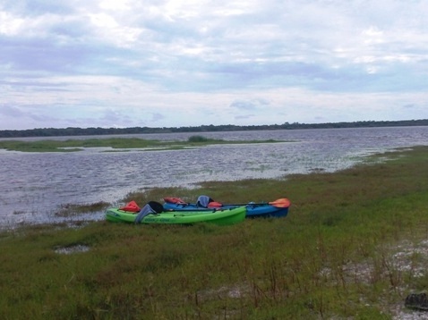
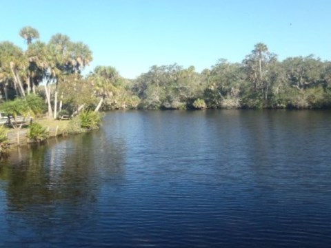
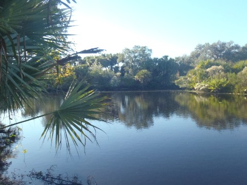
Paddling on South Side of Lake Myakka
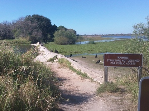
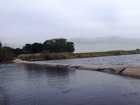
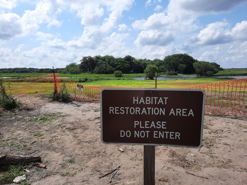
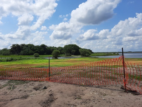
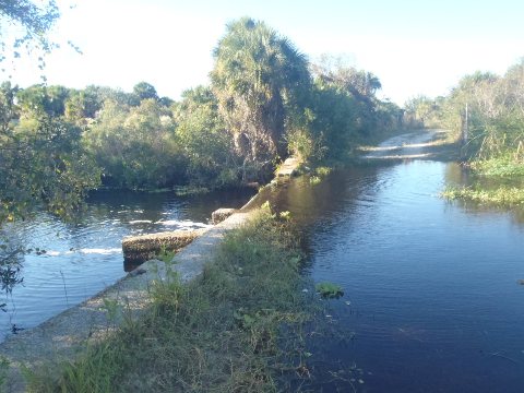
We launched from the boat ramp at the parking lot near the Myakka Outpost and paddled around the lake. In these photos, we stopped at the dam (weir), which has now been removed. Built by the CCC in 1938, it separated the upper lake from the river in an effort to improve lake levels for boating and fishing during dry season. While well-intentioned, over the years the ecological effects became apparent in the disruption of plant and wildlife communities and it was removed as part of a long-planned habitat restoration project in early 2022.
From a paddling point of view, this removes an obstacle - the dam was impassable at low water and difficult at high. We viewed the former dam site from the hiking trail, access to the river by land was blocked during restoration. We look forward to paddling here on a future visit and will update this report.
Paddling to the (former) Dam
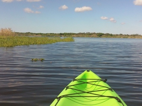
Onto Myakka River from North Side of Lake Myakka
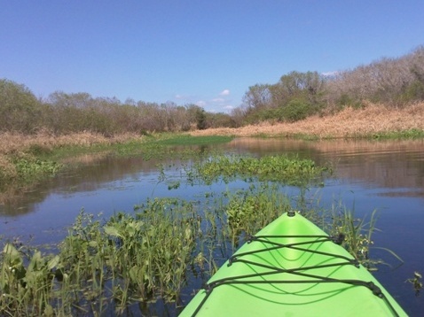
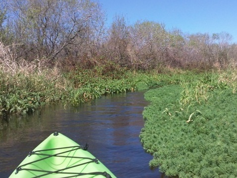
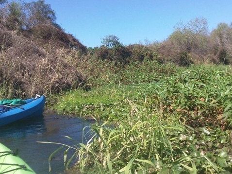
We paddled across the lake to the upper Myakka River, which enters at the north end of Lake (tricky to find at first). The river at this point is very narrow. About a half mile upstream we ran into dense vegetation and turned back (both at low and high water). Further upstream it would have widened but we didn't visit that area.
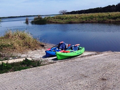
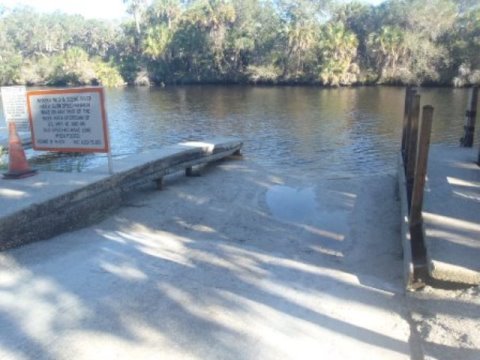
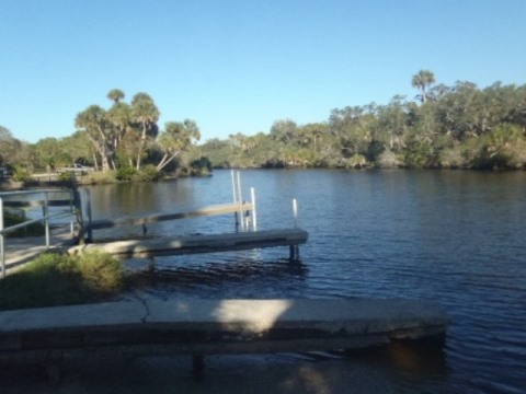
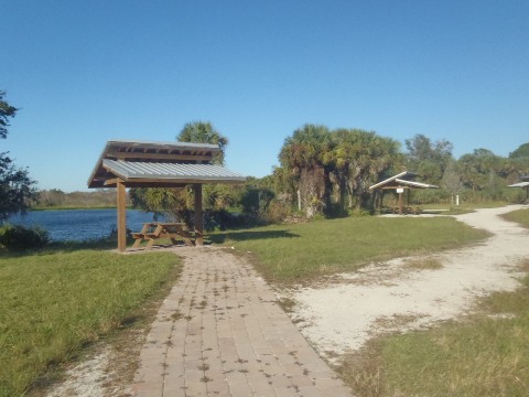
Launching onto the River from the Park Road
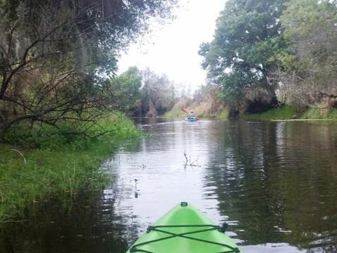
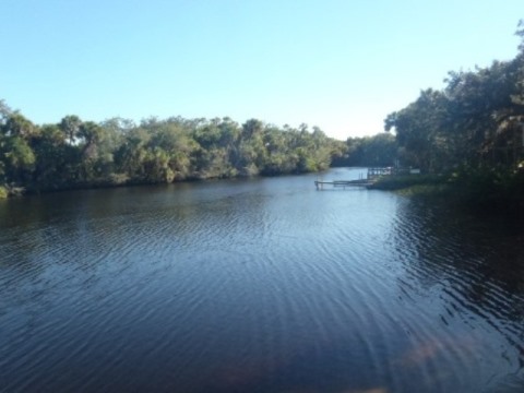
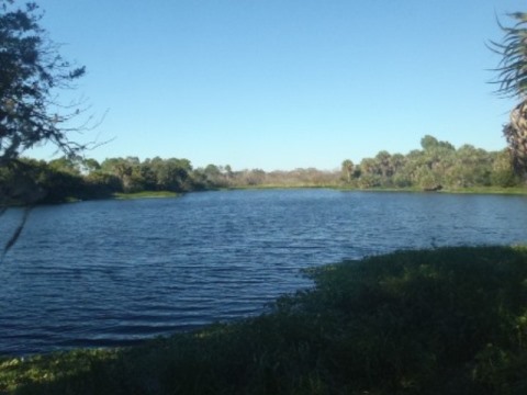
Myakka River to Lower Lake Myakka
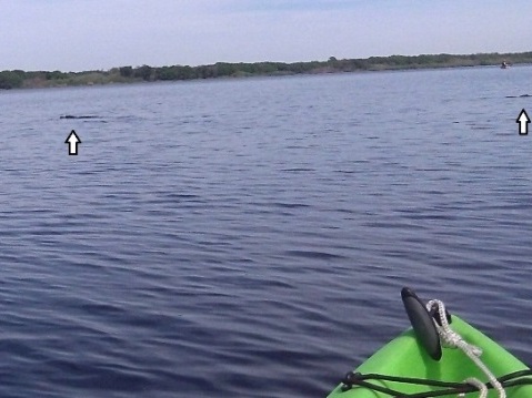
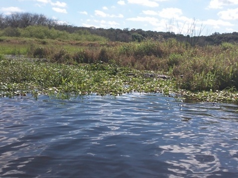
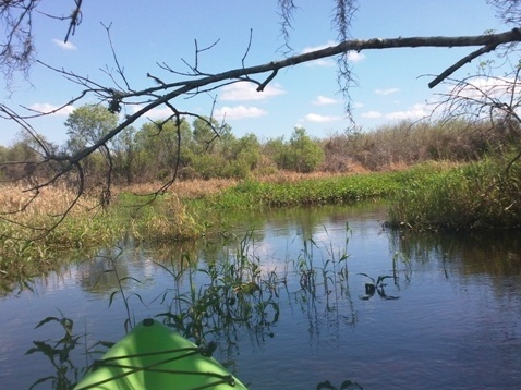
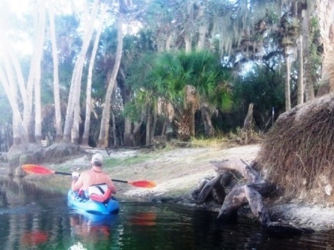
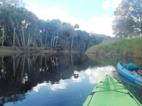
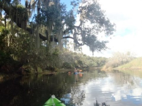
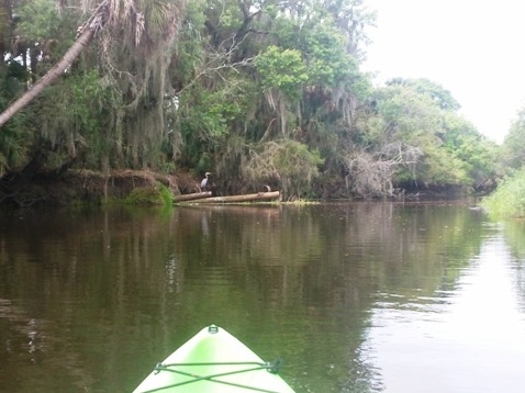
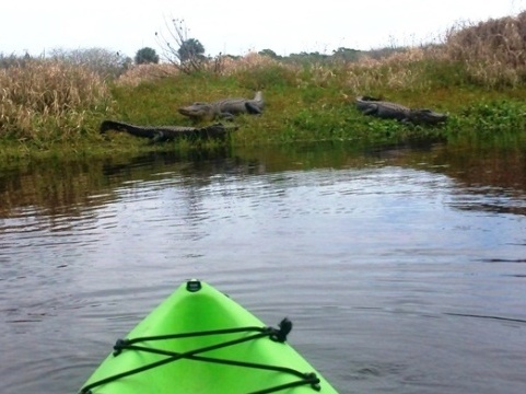
From the Park Road Launch on the river, we paddled upstream to the dam (Upper Lake Myakka), then downstream to Lower Lake Myakka. Between the lakes, the river snakes through the park and around several islands where it's possible to stop to stretch or picnic, though some areas may not be accessible at high water. As all along this river, gators and birds are in abundance!
Launch to Lake Myakka (upper)
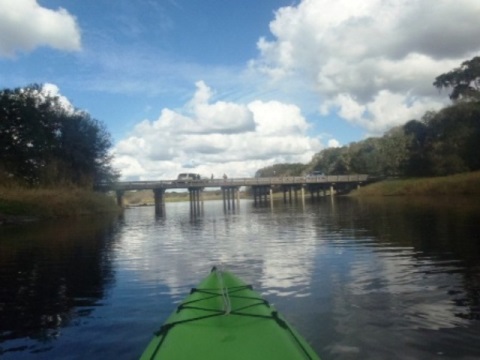
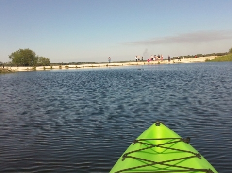
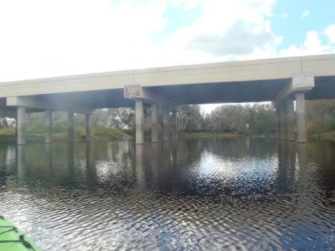
We used the launch near the Park Road bridge and paddled upstream to the dam at Lake Myakka. At the Park Road bridge, people are often seen fishing and photographing the gators on the bank. Note: As reported above, the dam has been removed - we'll update this trip report on a future visit.
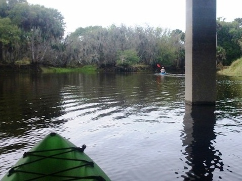
Launch to SR72 Bridge
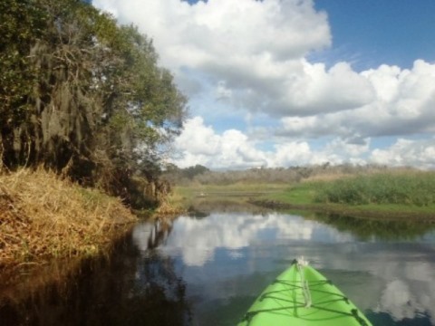
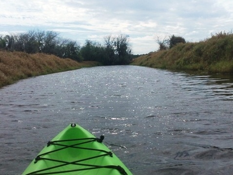
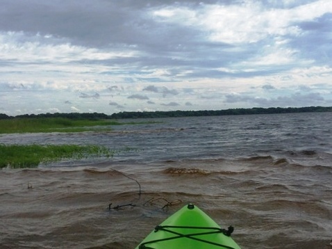
We launched off the park road near the Park Road bridge, and paddled to Lower Lake Myakka. The top section has some tree cover, but then it opens into prairie with no shade to Lower Lake Myakka.

SR72 Bridge to Lower Lake Myakka
As a "wild and scenic river," river access is limited. The area south of the SR 72 bridge is a designated wilderness preserve, so we got our passes at the ranger station at check-in. The first day we were too late, they often sell out quickly (only 30 are allowed per day) so we went back early on our second day and were successful!
Myakka River State Park
About the Park
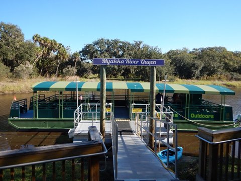
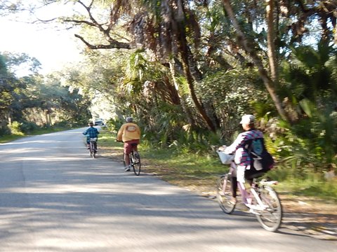
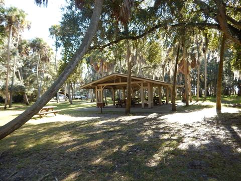
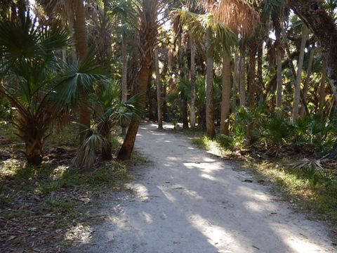
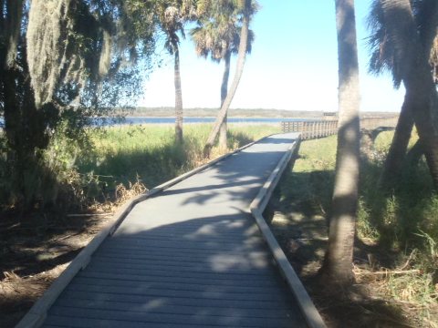
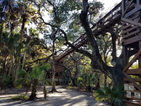
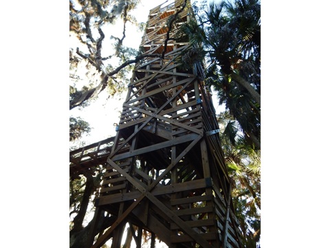
Myakka River State Park is one of Florida's oldest (developed by the Civilian Conservation Corps in 1934) and largest (58 square miles) state parks. The park has hiking, fishing, camping, geo-seeking, and wildlife observation. Bicycling is popular on 7 miles of paved park roads, plus 12 miles of equestrian trails are provided. Boat tours, an observation tower and boardwalk offer different views of the park and river. The Canopy Walkway is a fun activity - the trail is suspended 25 feet above ground and goes 100 feet through treetop canopy to an observation tower. State Park fees apply.
Wildlife
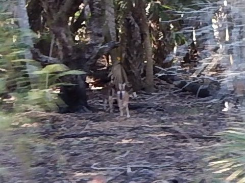
Known for the large number of alligators and birds, we saw many plus turtles and even deer.
Nearby Launches
In addition to the launches at the park (along the park road, at the boat ramp, or at Myakka Outpost), public access is also available at Sarasota County's Snook Haven Park and Deer Prairie Creek Preserve, south of the park.
Snook Haven Park
Formerly a fish camp, Sarasota County bought the property in 2006. Parking, boat ramp, kayak/canoe launch, fishing, picnic, restrooms, gift shop, restaurant.
Deer Prairie Creek Preserve
Deer Prairie Creek Preserve covers 6,400 acres and protects 6 miles of riverfront. Parking, kayak/canoe launch, portable restrooms, picnic, hiking and equestrian trails. A small dam forms a pond.
More Information and Resources
Nearby Paddling:
South Creek at Oscar Scherer State Park
See FL West-Central Region
for more paddling
Nearby Biking:
Myakka River
State Park (eco-biking)
Legacy Trail
Related Resources:
Florida State Parks -
Myakka River State Park
SW FL Water Management District - Deer Prairie Creek Preserve
Sarasota County - Snook Haven Park
View great paddling by FL Region or Listed A - Z

PaddleFlorida.net... Find Florida's Best Recreational Paddling,
by Kayak, Canoe, and Paddleboard too.
Copyright © PaddleFlorida.net. All Rights Reserved. Paddle Florida®