Paddle Florida®
Over 100 Florida Paddling Destinations
E-Z Maps... Photos... Reports...
You are here > Home >
South Florida >
Great Calusa Blueway >
Imperial River
Trip report: December 2019
Imperial River Paddling...
Great Calusa Blueway, a Freshwater Gem at Old Bonita Springs
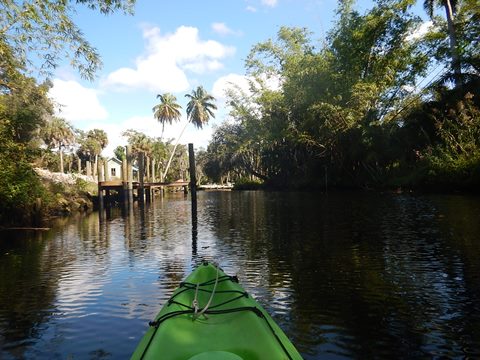
The Imperial River is part of the Estero Bay Region of the Great Calusa Blueway. The entire river runs about 9 miles east-west, from Flint Pen Strand Preserve through Bonita Springs to Estero Bay. The most scenic paddling is on the upper freshwater portion. We launched in old downtown Bonita Springs and paddled about 3 miles upstream and back, 6 miles total. Very enjoyable; a light current, clean freshwater, lots of wildlife. Many homes along the river, but also shade, shelter, and numerous uniquely Florida views - bring a camera. From the launch, paddlers also have the option of going downstream towards Estero Bay, where saltwater mangrove takes over, and sea kayaks are best. We paddled some this way, too. (Map and photos below.)
Distance: 9 miles (more on Estero Bay), best paddling is upper 3 miles (freshwater)
Location: Lee County
Difficulty: Easy upper section, moderate towards Bay
Tidal: Little or no influence upstream, yes towards Bay
Launch points: Bonita Springs (See map)
Nearby points of interest: Everglades Wonder
Gardens, Lovers Key State Park, Corkscrew Swamp Sanctuary
Rentals/Outfitters/Tours:
CGT
Kayaks, Inc. (Riverside
Park; on-site rentals, sales, tours)
Nauti
Exposures (Specializes in guided
photography and eco-tours)
Page Summary:
- Paddling on the Imperial River
- Paddling from Old Bonita Springs
- Depot Park
- Depot Park to Imperial Pkwy.
- Imperial Pkwy. to I-75
- Downstream from Depot Park - Riverside Park
- Some History
- More Information and Resources
Paddling on the Imperial River ... Comments and Photos
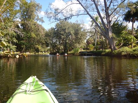
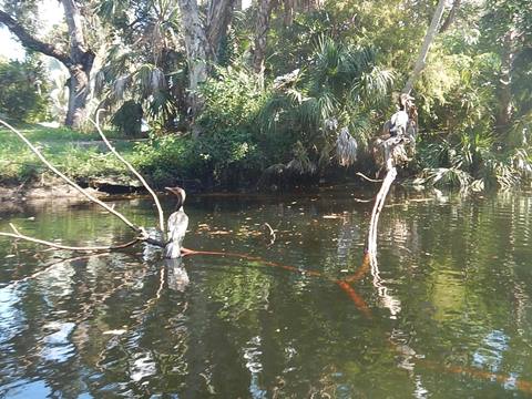
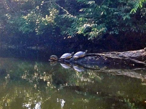
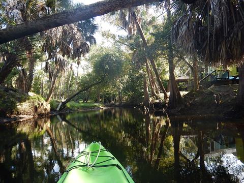
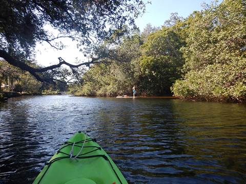
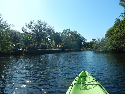
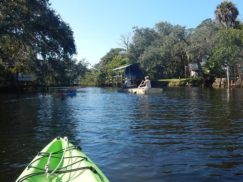
Paddling upstream from the hand launch at Depot Park, the River passes some unique older homes, then newer. Progressing upstream, the river gradually narrows with shade increasing. There are several small slices of nature, with palms, cypress, and oaks draped in Spanish moss, providing glimpses of semi-tropical freshwater beauty that is rarely seen elsewhere in Southwest Florida today. At the I-75 bridge, the water becomes too shallow for most paddlers to continue. (A launch at Cullums Bonita Trail provides limited access to the eastern "river," a canal draining Preserves.) The many native birds and turtles are now used to kayaks, so plenty of photo opps. Alligators and manatee are often reported, but we didn't see any this day. While the beaches on the Gulf are the big draws, this is a paddling gem, the type of sheltered, clear "small water" paddling we enjoy most. Homes aside, this part of the river retains an Old Florida vibe. And returning with the current is always a big plus!
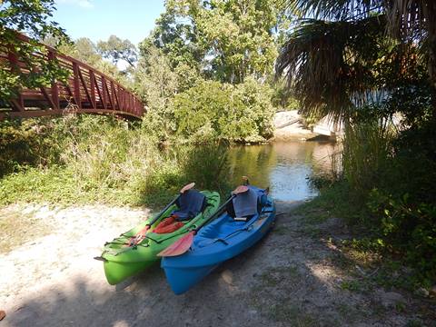
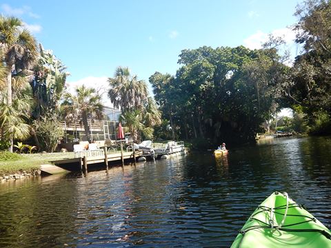
Paddling from Old Bonita Springs
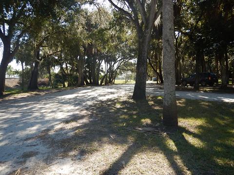
Depot Park
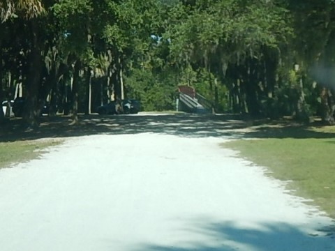
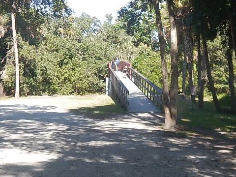
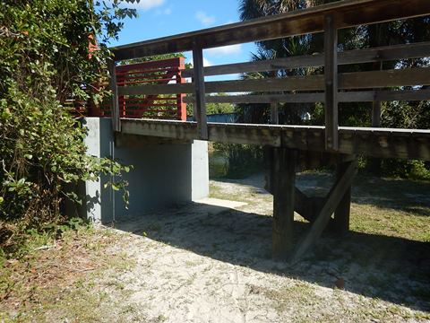
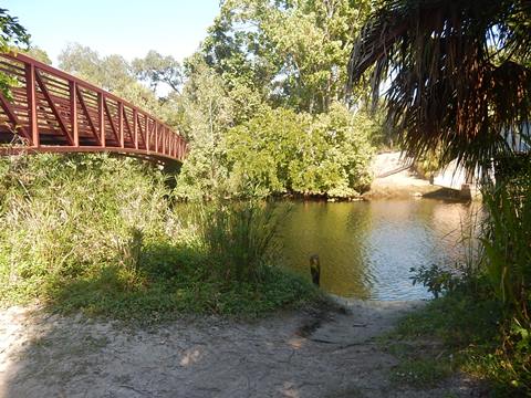
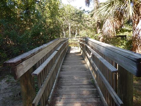
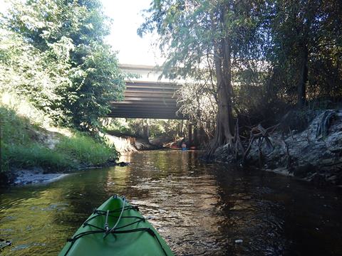
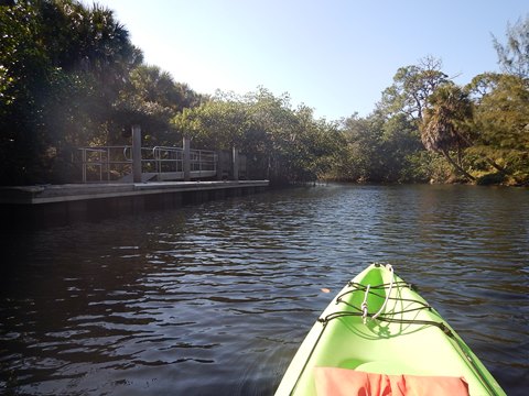
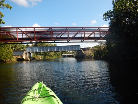
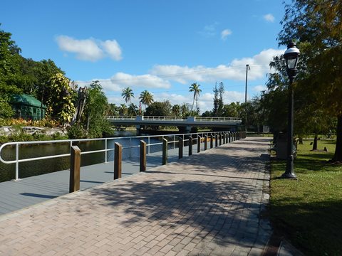
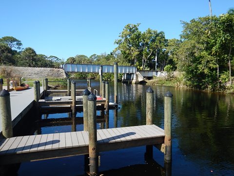
A free hand launch is at Depot Park west side of US 41, on the other side of the railroad track from Riverside Park. The launch is nestled between a footbridge and railroad trestle spanning the river. A narrow space, but easy on and off. Depot Park has free parking, restrooms, playground, and a floating dock. An outfitter offers photography and eco-tours from here (link above).
Note: An older looking paved ramp is on the east side of Old US 41, but we're not sure about parking fee.
Depot Park to Imperial Pkwy.
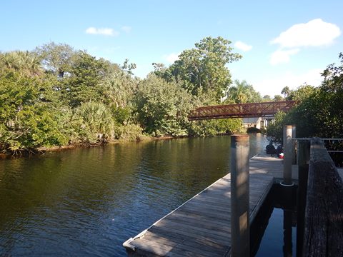
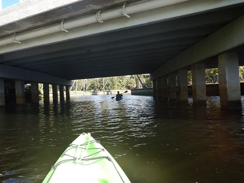
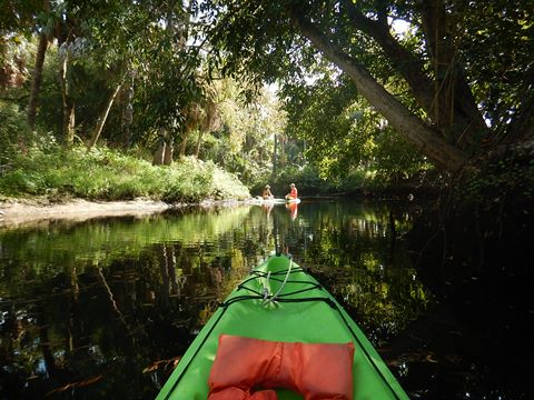
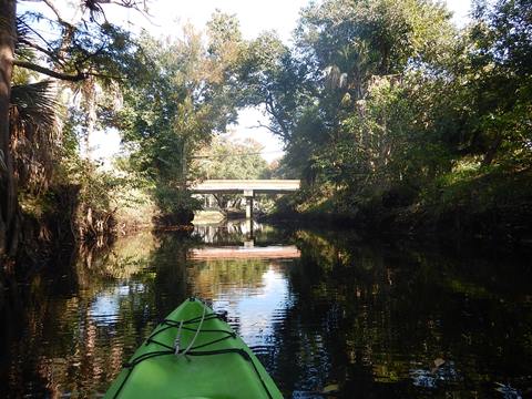
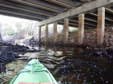
Leaving the launch and heading upstream, you first paddle under the railroad trestle, past the rentals at Riverside Park, and then under Old US 41. There are many homes along the way here, but some of the older architecture is interesting. With light current, this section is an easy paddle suitable for all skill levels. Some shade and banks help shelter from any wind.
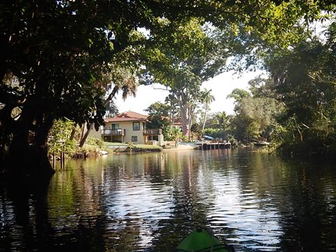


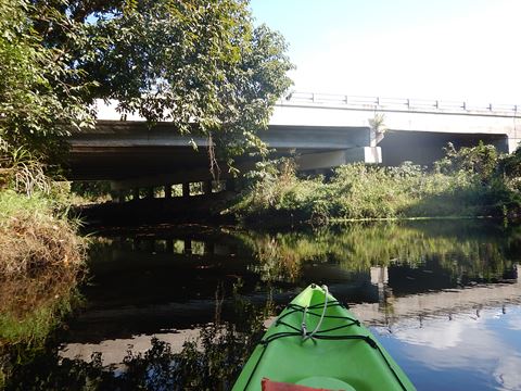
Imperial Pkwy. to I-75
Here the river progressively narrows with some twists and turns to navigate, especially after Bourbonnaire Drive. There are still homes, though fewer. This section is more challenging (and fun) approaching the I-75 bridge, at which the prospect of getting out and portaging convinced us to turn back.
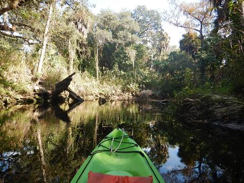
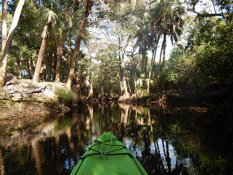


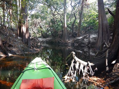
This was our favorite section, more intimate and the cypress becoming more dominant (watch 40 sec. video).
Downstream from Depot Park
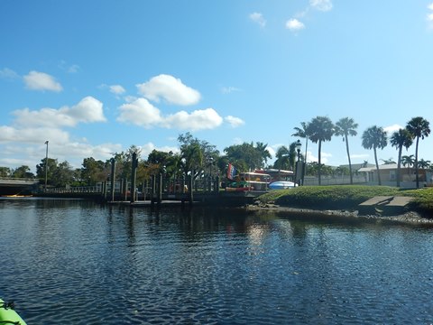
From the launch, we also paddled just a short distance downstream. Here it is wider and we saw more recent development. There's another launch at River Park off (new) US 41 about 2 miles down, but we didn't visit. The river gets wider and busier with motorboats as it approaches and then empties into Estero Bay.

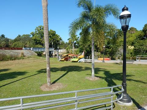
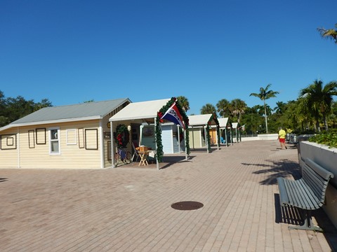
Riverside Park
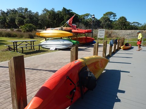
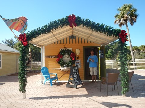
Riverside Park is located downtown between Old US 41 and the railroad track. An outfitter (link above) uses the docks here for on-site rentals and tours. The Park includes the historic Liles Hotel (1926), artist cottages (tourist cabins built in 1945), a butterfly garden, band shell, and Veteran's Memorial. The outfitter operates out of Cottage #6, with a larger retail shop across Old US 41 at Wilson St. Check it out.
Some History
The area was settled starting in the 1870's when surveyors arrived. The town was originally called "Survey" and the river "Surveyors Creek." The names were changed in 1915 as the area grew, to provide more sales appeal. Likewise, Bonita Beach was renamed from Fiddlerville, originally named for its many fiddler crabs.
More Information and Resources
Nearby Paddling:
Great Calusa Blueway Overview
- more paddling options along the Blueway
See FL South Region
for more paddling
Related Resources:
Bonita Springs - Riverside Park
Bonita Springs - Depot Park
Lee County Visitor Bureau: Explore Estero Bay
View great paddling by FL Region or Listed A - Z

PaddleFlorida.net... Find Florida's Best Recreational Paddling,
by Kayak, Canoe, and Paddleboard too.
Copyright © PaddleFlorida.net. All Rights Reserved. Paddle Florida®