Paddle Florida®
Over 100 Florida Paddling Destinations
E-Z Maps... Photos... Reports...
You are here > Home >
Florida Panhandle >
Apalachicola River WEA
Trip report: May 2016
Kayaking in Apalachicola River WEA...
Paddling on Graham Creek and Visiting Paddling Trail Launches
The Apalachicola River Wildlife and Environmental Area (ARWEA) Paddling Trail System, located just above the river delta, contains 11 numbered paddling trips totaling over 100 miles (see "Related Resources" at bottom of page for the complete ARWEA paddling guide). For recreational paddlers looking for wildlife and some rare photo opportunities, we recommend "Trip 1" - the short-trip option on Graham Creek and its tributaries. This trip is all freshwater, providing a greater variety of scenery than other, mostly brackish water trips. It's also an out-and-back paddle, so unlike the long-trip option, no shuttle is required. (Map and photos below)
Distance: varies
Location: Gulf and Franklin Counties
Difficulty: Easy to moderate
Tidal: Yes
Launch points: Numerous; documented here are Graham Creek,
Gardner Landing, Bloody Bluff, Cash Creek, Whiskey George Creek, and Doyle Creek
(See map)
Nearby points of interest: Apalachicola, St. George Island
Rentals/Outfitters/Tours:
N/A
Support and Advocacy:
Apalachicola Riverkeeper
Page Summary:
- Paddling at Apalachicola River WEA
- Six Launches
- Paddling on Graham Creek and Tributaries
- Upstream, Deep Creek
- Downstream - South Prong, East River - More Information and Resources
Paddling at Apalachicola River WEA... Comments and Photos
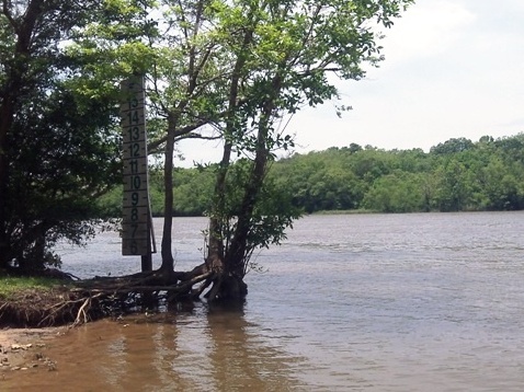
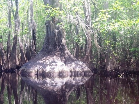
The ARWEA covers 86,140 acres and contains the largest expanse of floodplain forest in Florida. Much of the ARWEA Paddling Trail System is marsh-grass creek and flats, great for fishermen and campers, but not very scenic for recreational kayakers. The major freshwater components of the Trail System, Graham Creek and East River offer a greater diversity of plants and wildlife. In this section, alligators are common. Birdlife abounds.
We recommend this area on a sunny day during the cooler months, late autumn to early spring. April is often best, when the the trees are back in bloom, but the flies aren't as thick. The Wilderness Area is adjacent to Tate's Hell State Forest, and the name says it all. From May though September, the insects can be brutal. If you are in the area and want to do some paddling during the warmer months, a good nearby option is Apalachicola Bay at St. George Island.
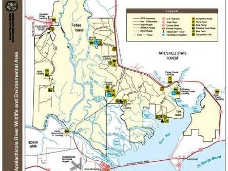
Six Launches
We visited six launches along SR 65 within the ARWEA
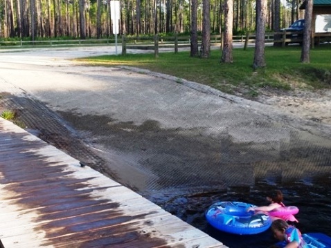
Cash Creek Landing
Parking, picnic, small fishing dock. That day, several families were picnicking and the children were enjoying the ramp and dock.
Whiskey George Creek Landing
Easy on and off. Large parking area, picnicking.
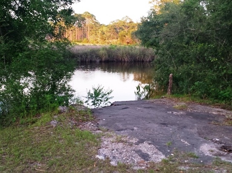
Doyle Creek Landing
Parking only. The ramp has deteriorated and it's a sharp drop to the creek.
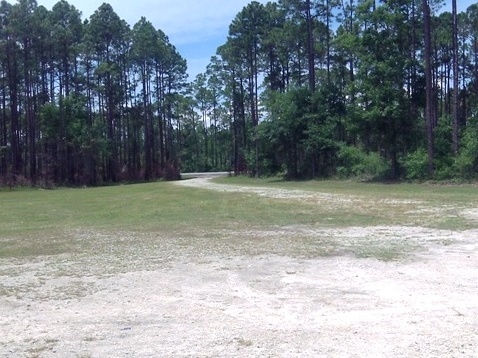
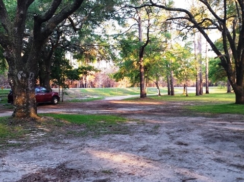
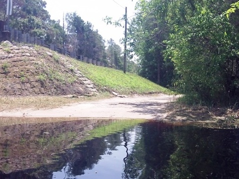
Gardner Creek Landing
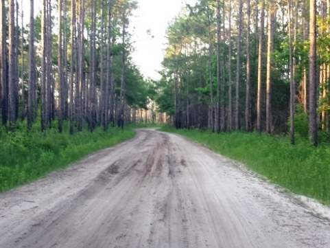
There are two ramps, ample parking and picnicking. A bike rack is provided for shuttling back to Graham Creek Landing, but portions of the road are very sandy making for a strenuous bike ride.
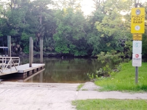
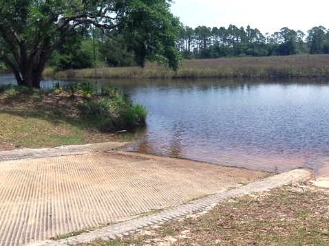
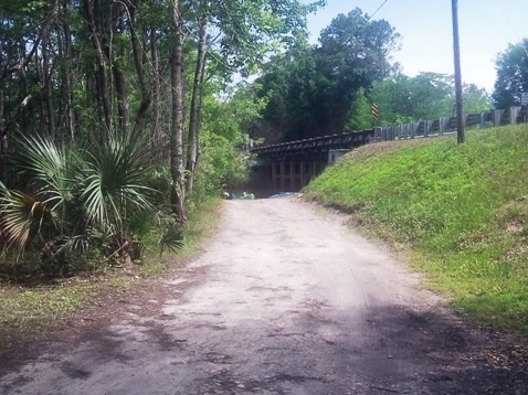
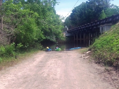
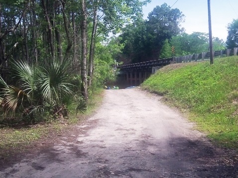
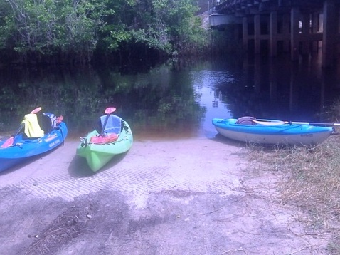
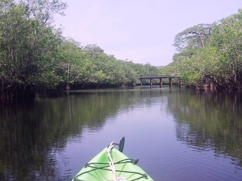
Graham Creek Landing
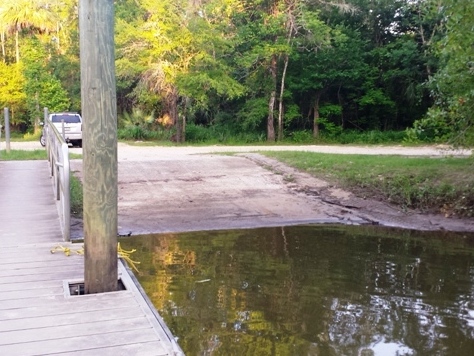
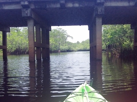
The landing is off SR 65 by the bridge. A long-time favorite of locals, the Graham Creek and East River long-trip is about 7.3 miles one way, from the Graham Creek launch to East River, and ending at Gardner Landing. From here by road (some sandy stretches), it's a little over 3.5 miles back to the launch. We paddled a portion of the out-and-back short-trip on Graham Creek - see details below.
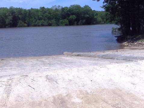
Bloody Bluff Landing
On the Apalachicola River. Its name is from 1816 skirmishes between American and Indian forces.
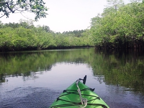
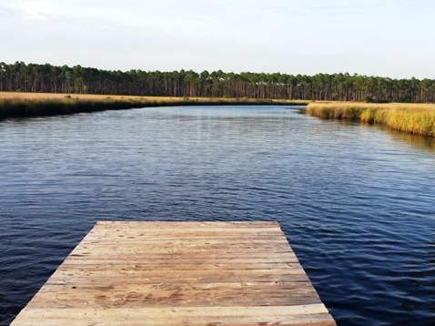
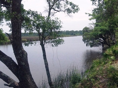
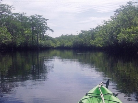
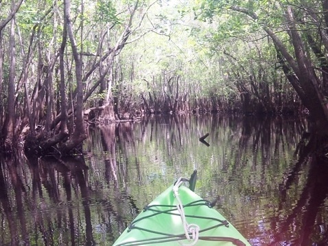
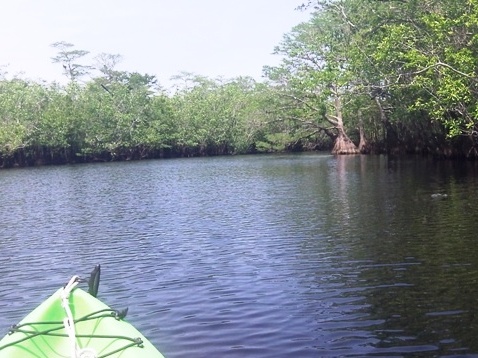
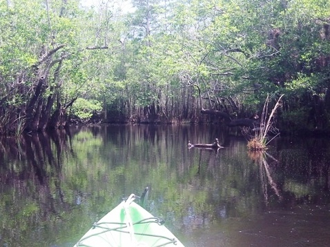
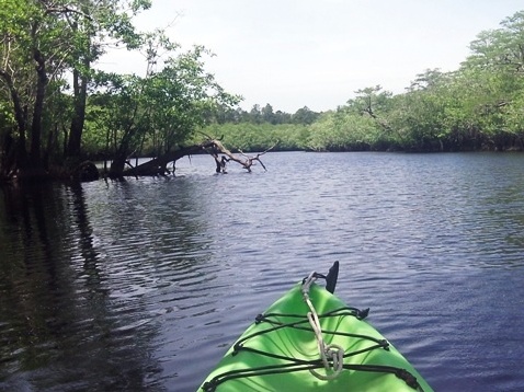
Paddling on Graham Creek and Tributaries
We paddled a portion of the out-and-back short-trip on Graham Creek. The upper section of the creek, plus two short tributaries are especially scenic. We saw a couple of slowly cruising alligators, some kites, many blackbirds, lots of tupelo, and a few uniquely shaped cypress trees.
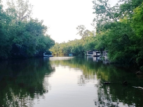
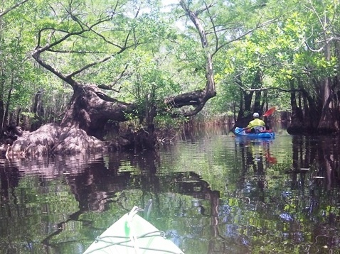
Upstream, Deep Creek
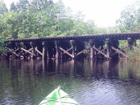
Graham Creek is a pristine blackwater creek through cypress and tupelo. We paddled upstream, under the SR65 bridge about a half mile to just past the railroad trestle. Here, Graham Creek splits to the right (impassable) and Deep Creek enters from the left. About 4 miles up Deep Creek, a primitive campsite (hand launch, picnic table, grill) marks the boundary of Tate's Hell State Forest.
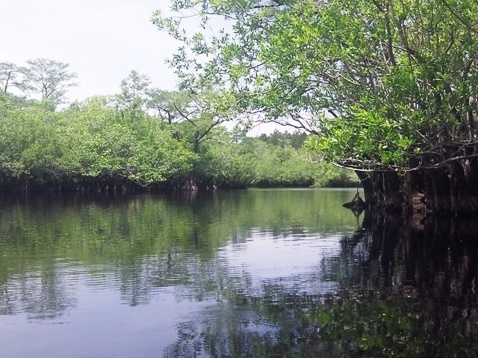
Downstream - South Prong, East River
South Prong enters on the right at about 0.2 miles. This is another one mile (round trip) of interesting paddling. Further downstream, Graham Creek widens and continues for about 2.5 miles before joining the East River. On this day, we only paddled a short distance before turning around. We had arrived too late in the season - the yellow flies were out in force.

More Information and Resources
Nearby Paddling:
Apalachicola Bay/St. George Island
See FL Panhandle Region
for more paddling
Related Resources:
Florida
Fish and Wildlife Commission - Apalachicola River
Paddling Trail System
Florida Fish
and Wildlife Commission - Trip 1 - Graham Creek and East River
View great paddling by FL Region or Listed A - Z

PaddleFlorida.net... Find Florida's Best Recreational Paddling,
by Kayak, Canoe, and Paddleboard too.
Copyright © PaddleFlorida.net. All Rights Reserved. Paddle Florida®