You are here > Home >
North Florida >
Potano Paddling Trail
Latest update: March 2023
Potano Paddling Trail...
Kayaking near Gainesville
The Potano Padding Trail is a Florida State designated trail, getting its name from an Indian tribe that inhabited the area until the late 1600’s. The trail consists of two distinct sections: (1) a circumnavigation of Newnans Lake (a mostly easy paddle), and (2) Prairie Creek (which can be a more technical paddle), from the southwest corner of the lake to the trail endpoint at the SR 234 bridge. (Detailed map and photos below.)
Distance: 11.5 miles around Newnans Lake plus 4 miles on
Prairie Creek
Location: Alachua County (Gainesville)
Difficulty: Easy to moderate
Tidal: No
Launch points: Earl P. Powers County Park, Palm Point City
Park, Owens-Illinois County Park (See map)
Nearby points of interest: Paynes Prairie Preserve State Park,
Marjorie Kinnan Rawlings Historic State Park (Cross Creek), University of Florida
Rentals/Outfitters/Tours:
Adventure Outpost (guided tours)
Support and Advocacy:
Page Summary:
Potano Padding Trail... Comments and Photos
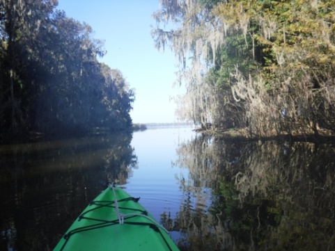
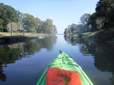
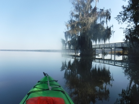
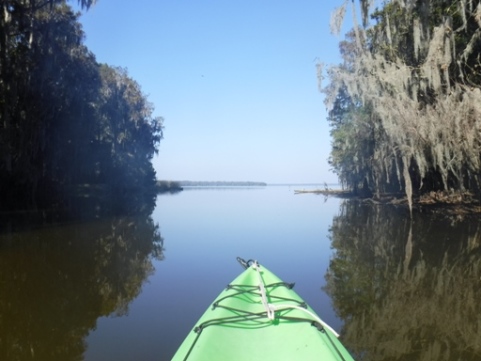
For most paddlers, Prairie Creek is the main attraction of the trail - from the boat ramp/launch at Earl Powers County Park the entrance to Prairie Creek is to the right, about 3/4 mile.
Potano Paddling Trail Launches
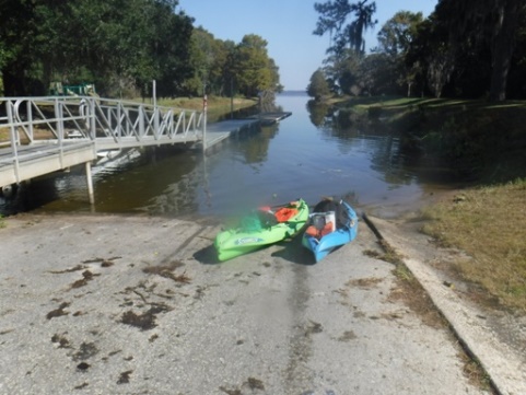
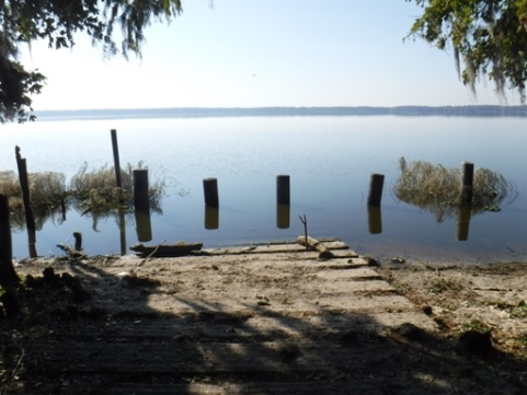
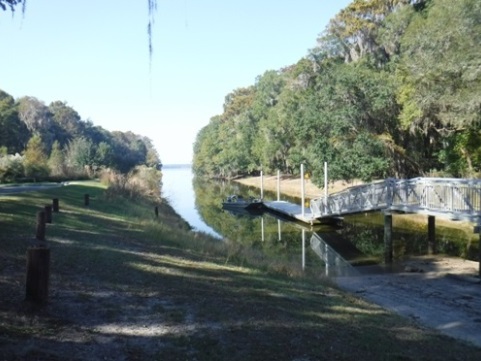
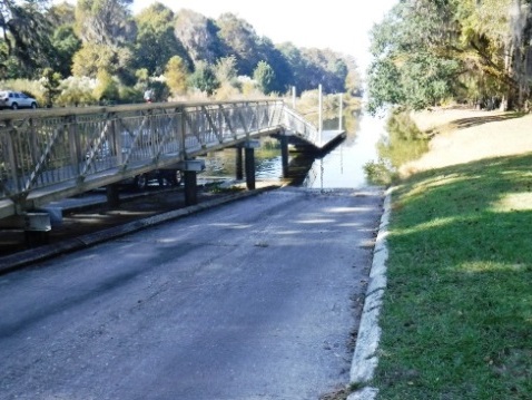
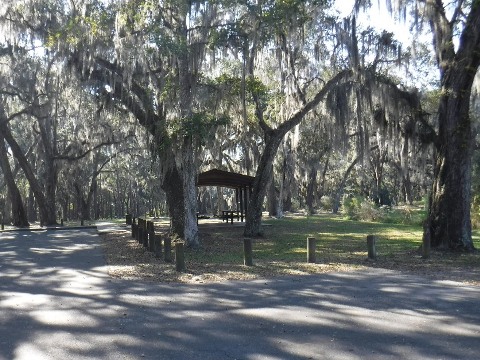
Earl P. Powers County Park
Most popular. Easy on and off, closest to Prairie Creek. Parking, restrooms, fishing, picnic, playground.
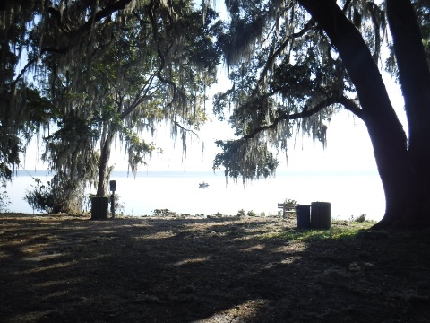
Palm Point City Park
From parking, about 200 feet on path to launch. Parking, no facilities. Popular with fishermen and birdwatchers.
Owens-Illinois County Park
Easy on and off. Parking, picnic, fishing, playground.
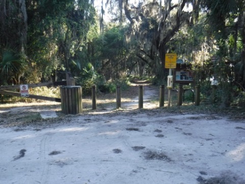
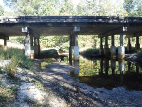
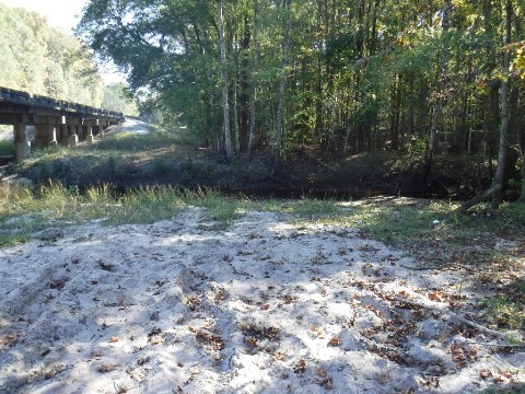
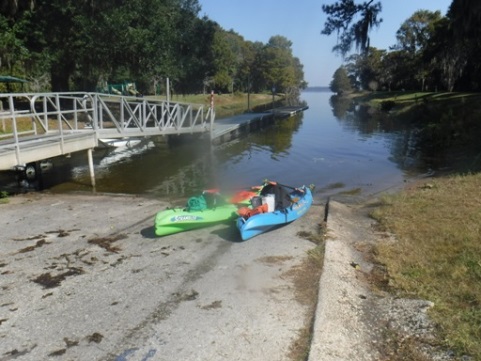
CR234 Bridge
Take-out point for end of paddling trail on Prairie Creek. Limited parking, no facilities.
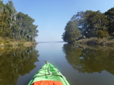
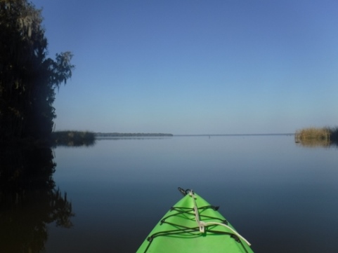
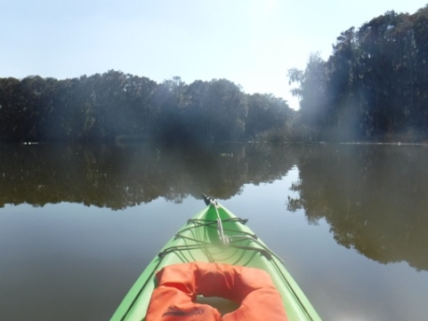
Paddling on Newnans Lake
Newnans Lake, almost completely undeveloped and
lined by cypress, is about 7,500 acres at normal levels and is a
popular fishing lake. It's about 11.5 miles to circumnavigate, open
to the elements. Popular for fishing, this is not the type of water
a recreational paddler typically seeks out although channels along
the shoreline do offer some shelter and birdwatching opportunities.
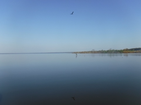
Wildlife include eagles, ospreys, and great blue herons
among many other birds. Alligators and otters can also be seen.
The lake has some interesting geological features. It sits atop the Hawthorne Formation, a layer of phosphate rich clay, which gives the water a cloudy, grayish tint. While the water is not as pretty or reflective as most Florida lakes, it is rich in natural nutrients which support a food chain attracting a large number of aquatic birds.
Archaeology:
During a drought in 2000, the remnants of over 100 Indian dugout canoes ranging from 500 to 5,000 years old were discovered in the dry lake bottom. As it turns out, this is the world’s largest discovery of ancient watercraft. Consisting of remnants and fragments too fragile to move, they remain in the lake. Read more about this archaeological find .
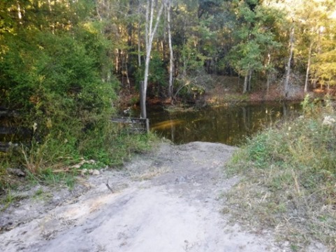
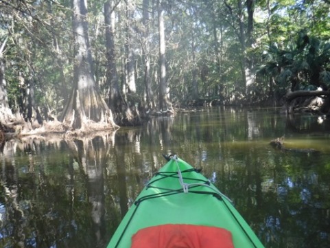
Paddling on Prairie Creek
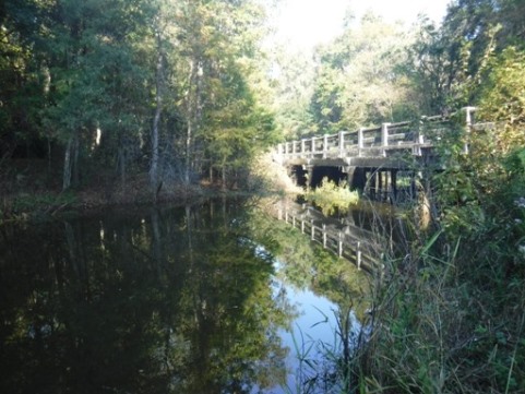
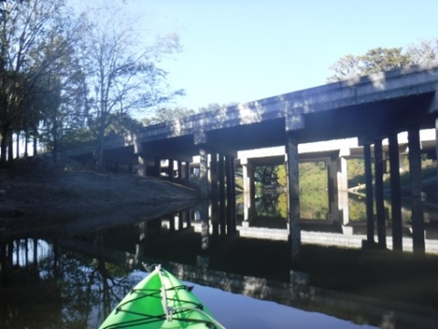
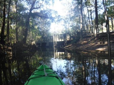
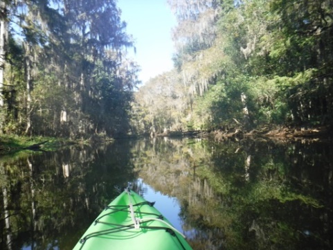
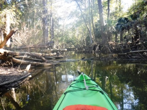
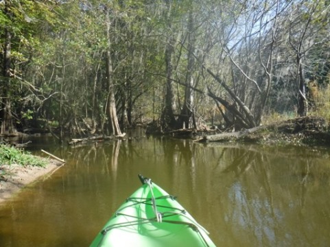
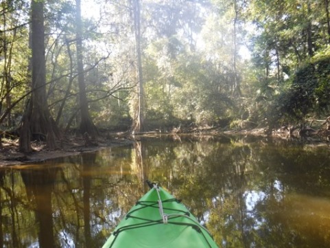
As it leaves the lake, Prairie Creek passes under Hwy 20 and a bike bridge of the Gainesville-Hawthorne State Trail. Here, water levels are important: too low and the creek becomes a series of downed logs and pullovers; too high and you will not be able to pass under the bike trail bridge. At normal water levels, the creek is narrow and shallow with many twists and turns. The bank is lined with cypress knees and shaded by cypress, pine and oak. Numerous small gators, waterbirds and deer can be seen.
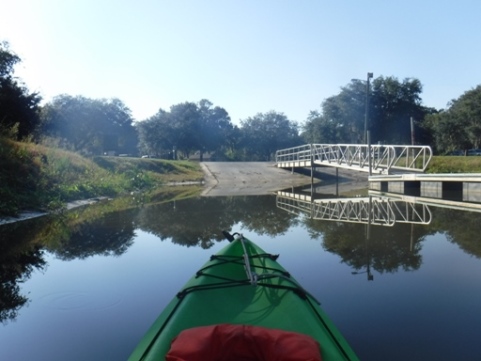
From the Hwy 20 Bridge, it is a little less than 4 miles to the take-out at CR234. For about the first 2.5 miles the creek remains in its natural state. Then about 1.2 miles before the CR234 take-out, you will see a steel water control gate. Here the creek becomes a dug-out canal leading to the take-out. Camps Canal ultimately empties into Orange Lake, but it becomes impassable shortly beyond the take-out.

More Information and Resources
Nearby Paddling:
See FL North Region for more paddling
Nearby Biking:
Gainesville-Hawthorne State Trail
Related Resources:
Florida Office of Greenways and Trails-Potano Paddling Trail (.pdf)
Florida Fish and Wildlife Conservation Commission-Newnans Lake